Equipment Title and Description | Display |
GPS 1230 with RTK configurationMeasurement precision and accuracy in position and accuracy in height are dependent upon various factors including the number of satellites, geometry, observation time, ephemeris accuracy, ionospheric conditions, multipath, etc. The figures quoted assume normal to favorable conditions. Times required are dependent upon various factors including the number of satellites, geometry, ionospheric conditions, multipath, etc. GPS and GLONASS can increase performance and accuracy by up to 30% relative to GPS only. A full Galileo and GPS L5 constellation will further increase measurement performance and accuracy. The following accuracies, given as root mean square, are based on measurements processed using LGO and on real-time measurements. | 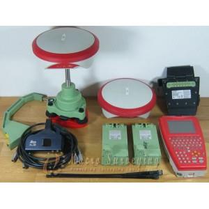 |
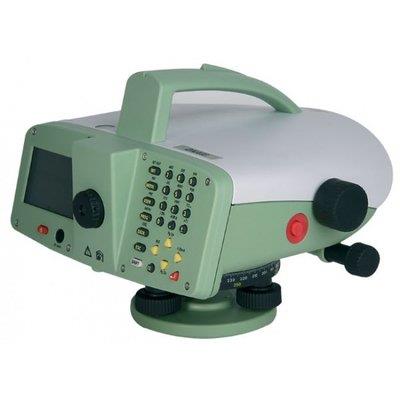
LEICA DNA 03 Digital LevelPrincipal of measurement The bar code of the staff is stored in the instrument as a reference signal. When measuring, the visible section of the staff within the field of view is captured by the line decoder as a measuring signal. Then the measuring signal is compared to the reference signal. This results in the height reading and horizontal distance. The staff must be perpendicular during measurement, for optical leveling. With artificial lighting of the staff, measurements can be made in the dark (The sensitivity of the sensor ranges from the highest frequencies of visible light down to the frequency of infrared light). |
 |
Leica Robotic Total Station TS12 R1000Leica Viva TS12 is packed with features, such as the unique PowerSearch sensor which finds prisms regardless of their location in seconds, and the lightweight Leica CS10 controller which provides secure wireless connectivity to the total station. Together with the easy-to-use Leica SmartWorx Viva software, robotic surveying has never been so easy and productive. Leica Viva TS12 uses years of experience to optimally find, lock and measure prisms with a single key press. With the unique PowerSearch sensor any prism type is found within seconds regardless of location. The ergonomic and lightweight Leica CS10 Radio field controller with the fully integrated Antenna technology offers a long-range, secure and fast wireless connectivity to your TS12 total station. SmartWorx Viva LT is designed with simplicity in mind using clear graphics, logical menu structures, non-technical terminology, and simplified workflows. Original Leica Geosystems Accessories guarantee seamless operation and maximum performance, as all accessories have been meticulously designed for the instrument. | 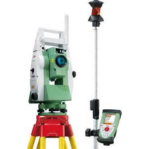 |
Leica TS 06 Total Station The Total StationLeica FlexLine TS06plus allows you to work quickly and effectively. Electronic Distance Measurement: Wherever high-distance measurement accuracy is required, you can face the challenge of this demanding task with the TS06plus. It provides the most accurate Electronic Distance Measurement. The Leica FlexLine TS06plus Communication Side Cover enables cable-free connection to any data collector via Bluetooth, for example, the field controllers Leica Viva CS10 or Leica Viva CS15 with SmartWorks Viva software. The USB stick enables the flexible transfer of such data as GSI, DXF, ASCII, LandXML, and CSV. Built-in user-friendliness: The full alpha-numerical keyboard. The Leica TS06plus standard built-in alpha-numerical keyboard enables fast and easy entry of numbers, letters, and special characters. It increases the work speed while at the same time reducing possible sources of error. FlexField plus Onboard Software: Easy to use due to its graphical guidance and intuitive workflows. | 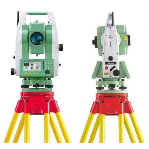 |
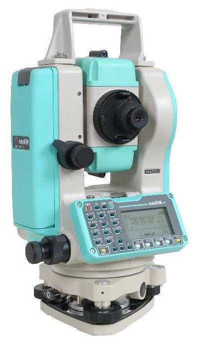
Nikon Total Station DTM 821Features for DTM 821 Total Station Powerful onboard computer system supports advanced onboard software applications Industry standard PCMCIA data card slot Large graphics-based display system Emergency backup memory system (Nikon unique) 1" angle accuracy Fast and accurate (2mm + 2ppm) EDM system Lumi-guide point system with distance control Standard preinstalled data collection and stakeout software TDS-800 Data Collection Software V4.11 with Road Layout |
 |
LMH Series Electronic Self-Leveling Rotary Laser-LMH LMHSeries Rotary Lasers ANTI-DRIFT SYSTEM POWER MANUAL Automatic Self-Leveling Rotary Laser LMH 4. LMH SERIES APPLICATIONS Use your LaserMark® LMH Series Automatic Self-Leveling Laser for these and many other projects: Outdoor General Construction Applications & Site Preparation, Grading & Excavating, Batterboards and Foundations, Masonry Work, Setting Concrete Forms, Machinery Installation, Marking Elevation, Septic Work, Paving Roads, Driveways, Checking Depth of Trenches. The laser light can be used to reference elevations with the use of a laser detector. | 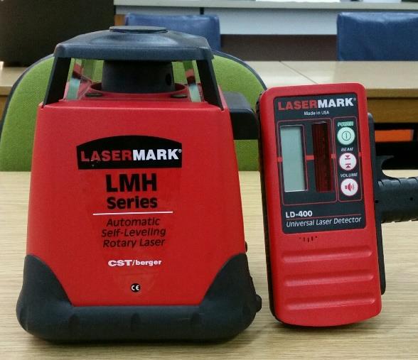
|
Self-Reducing Alidade with plane table equipmentThe Wild RKI Self-Reducing Alidade is a robust, compact, and easily-handled instrument which combines a telescopic alidade, a self-reducing Tacheometer, and a convenient plotting device, with a large selection of interchangeable scales, for the immediate and neat plotting of detail by bearing arid distance. Similar in principle to the RDS Self-Reducing Tacheometer, it has a 25x magnification, internally-focusing telescope, with a routable eyepiece inclined at 45° to the optical axis, allowing the observer to work comfortably and without bodily strain. It is ideal for all practical plane-table work and, with its ancillary equipment, is unsurpassed as a means of teaching new personnel the basic elements of survey techniques. | 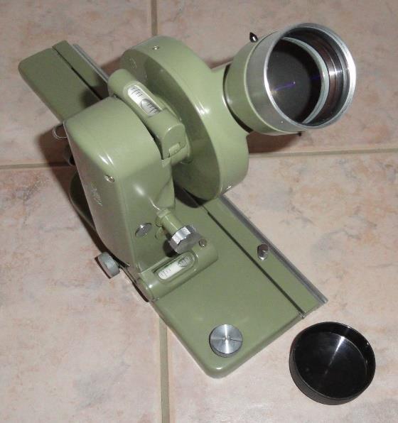 |